

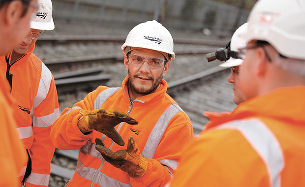
Recruitment


Harris Geospatial Solutions is a leading provider of software tools designed to help you get the information you need from your remotely sensed data.
We deliver the scientifically proven technologies you need to make accurate, informed decisions using remotely sensed imagery and data. Whether you need to determine the extent of damage from a natural disaster, manage infrastructure or ensure a safe military operation, our products provide you with critical geospatial awareness.
Our automated railway extraction capability lets you extract objects such as parallel tracks, centrelines and beacons from imagery and LiDAR quickly, accurately and in a way that makes it easy to integrate in your downstream processes. Learn more at harrisgeospatial.com


“For me it was a great networking opportunity to catch up with existing contacts.”


Latest Twitter Updates
Follow us @rail_media